

‘Ridgeway’ was a term that originated in Anglo-Saxon times, to refer to ancient tracks that run along the high ridges of hills. They are unpaved, relying simply on the hard ground to provide a suitable surface for travelling on. They provide a more direct route than the modern roads we use today; modern roads tend to be located on more level, flat ground in valleys.
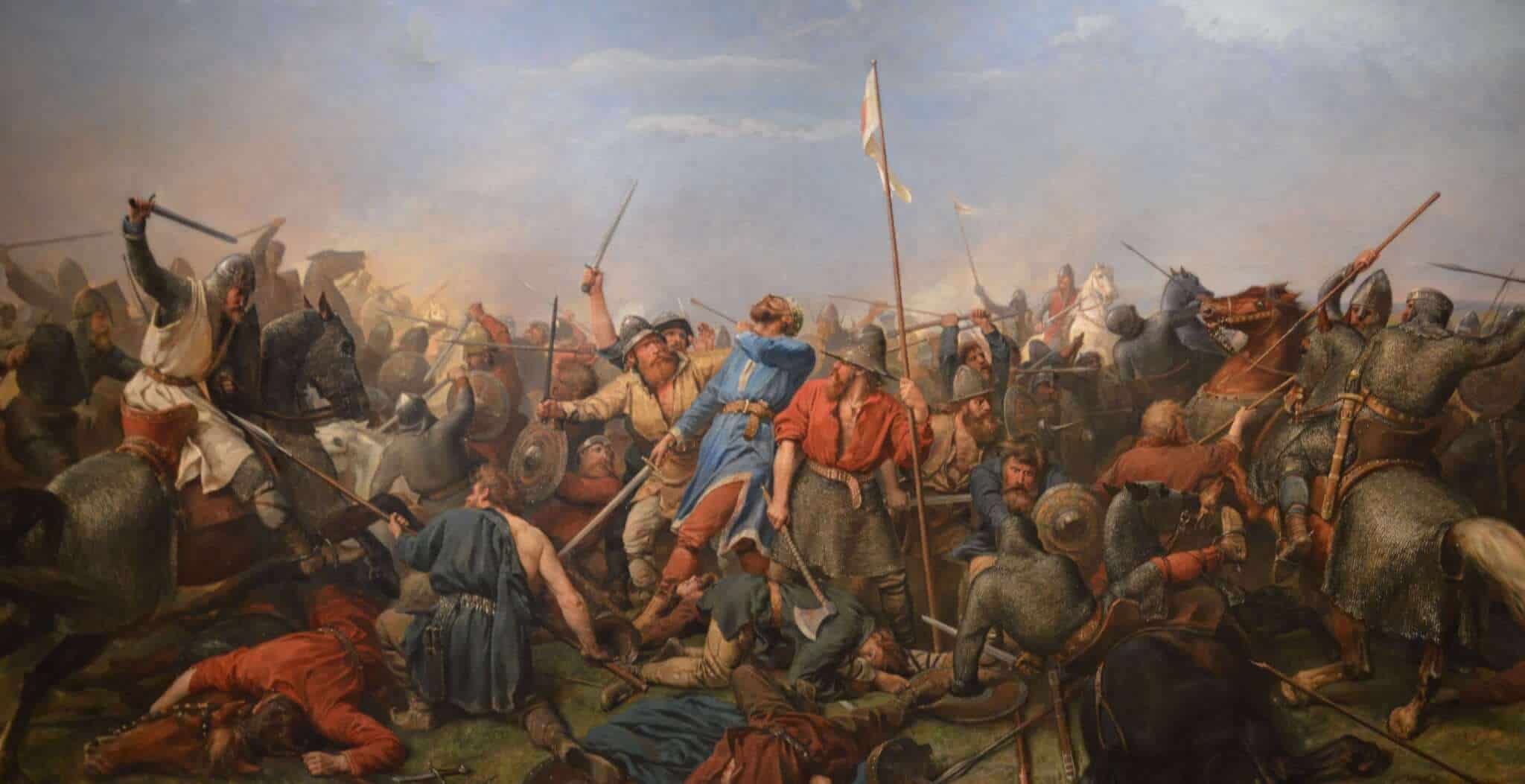
The Ridgeway in England stretches 85 miles (137km) from Overton Hill near Avebury, Wiltshire, to Ivinghoe Beacon near Tring, Buckinghamshire. It has been used for 5000 years by many different groups of people; travellers, farmers, and armies. During Saxon and Viking times, the Ridgeway was useful to provide a track along which to move soldiers into Wessex. In the medieval period, the route would have been utilised by drovers, moving animals to market. The Enclosure Acts of 1750 meant that the Ridgeway became more permanent and the route clearer, and it became a National Trail along with 14 others in England and Wales, in 1973. It is a public right of way.
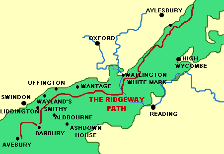
The Ridgeway could simply be described as a very long footpath, but there is much more to it. The Ridgeway passes through two Areas of Outstanding Natural Beauty, the North Wessex Downs (west of the Thames) and the Chilterns to the east. There are several picturesque villages, particularly on the Chilterns part of the Ridgeway rather than the Downs, where there are fewer settlements. It is the oldest road in Britain, and indeed the route is riddled with history.
Avebury, Wiltshire
Avebury is located between Marlborough and Calne, and is owned by the National Trust. About a mile away from the start of the trail at Overton hill, is Avebury Bronze Age stone circle. It is a World Heritage Site and one of the largest prehistoric monuments of this type in Europe.
This is close to Silbury Hill, the largest man-made hill in Europe. Many ancient tools dating back to the Stone Age have been found on this site, constructed from the shoulder blades of oxen.
Uffington, Oxfordshire
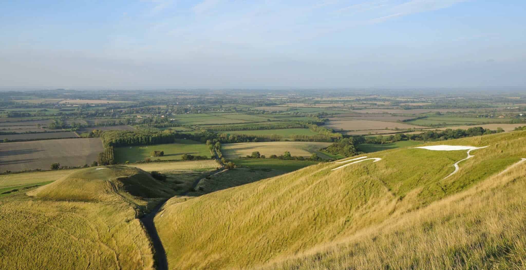
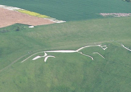
White Horse Hill in Uffington is very well-known and is the oldest hill figure in Britain, dating to the Bronze Age approximately 3000 years ago. The figure of the chalk horse is enormous (374 feet long) and is believed to have been constructed by digging trenches in the shape, and filling them again with chalk. The best views of this are from as far north as possible, perhaps from Woolstone Hill. Ideally, it should be seen from the air, possibly the creators’ intention, wanting the gods to see it!
Uffington Castle sits on the top of White Horse Hill, a fort from the Iron Age. It dates back to 600 B.C. At 857 feet high it stretches above the rest of the buildings in the county.
Close to this is the aptly named Dragon Hill, believed to be where St. George killed the beastly creature. The grass on the top of the hill has been worn away, and legend has it that it no longer grows where the dragon’s blood seeped into the ground.
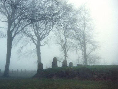
Wayland’s Smithy
This is a Neolithic burial mound (long barrow) 50m north of the Ridgeway, owned by the National Trust, which can be visited at any time. It is 5,000 years old, compared to the oldest parts of Stonehenge which are a mere 4000 years old! It was named by the Saxons, Wayland being a Saxon smith God. It was believed that Wayland had his blacksmith’s forge in the burial chamber. If you were to leave your horse outside it overnight, when you came to collect it, your horse would have new shoes! A suitable offering as payment would have had to have been left too, though!
Castles/hill forts
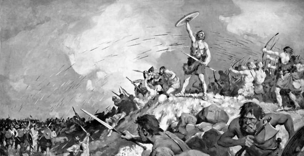
Hill forts were built to provide superior viewing over the valleys, vital to anticipate danger. They could protect trade routes and land more effectively. As well as Uffington Castle, there are two other Iron Age forts along the Ridgeway; Barbury and Liddington. Barbury is unusual because of its two lines of concentric earthworks. Liddington was a favourite of Richard Jefferies, who was a writer in the Victorian era.
Other places of interest
Snap – deserted village, near Aldbourne in Wiltshire.
Records have shown the village to have existed from 1268. In the mid 19th century it was a small but successful farming area, but this began to change as cheap American corn began to deprive them of trade. Their way of life rapidly declined but the last straw was Henry Wilson buying two of the largest farms in the village in 1905. He was a butcher and wanted to keep his sheep on the farms. This provided fewer jobs than the previous arable farming. People moved away to find work in surrounding towns. Now only sarsen stone and overgrown foliage remainswhere the village once was.
Ashdown House, Berkshire Downs, Oxfordshire
This house, built form the local chalk, is now owned by the National Trust and can be viewed Wednesday- Saturday 2-6pm between the months of April and October. It dates from the 1600s, when it was built for Elizabeth of Bohemia, sister of King Charles I, as a retreat from the Great Plague that was wreaking havoc in London. She actually never lived in it, dying before it was finished.
Wantage, Oxfordshire
Here in 849, King Alfred the Great was born. The blowing stone that he used to summon his army in 871 can be visited, too, just west of the village. There is even the Blowingstone Inn to have something to eat and drink in after exploring parts of the Ridgeway.
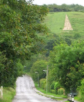
Watlington White Mark, Oxfordshire
This is another chalk hill figure. In 1764, the village vicar, Edward Home, was dissatisfied with his spire-less church. It offended him greatly, so he decided to act! He removed some grass on the hill to expose a chalk triangle. Then, looking from upstairs in the vicarage, it looked like the church had a spire. Problem solved!
This article presents the main highlights of the Ridgeway, but it boasts many more intriguing historical sites. There are several books that cover the route in great detail, to help you discover its hidden treasures!
Museums
View our interactive map of Museums in Britain for details of local galleries and museums.
Castles in England
Try our interactive map of Castles in England to browse our huge database.