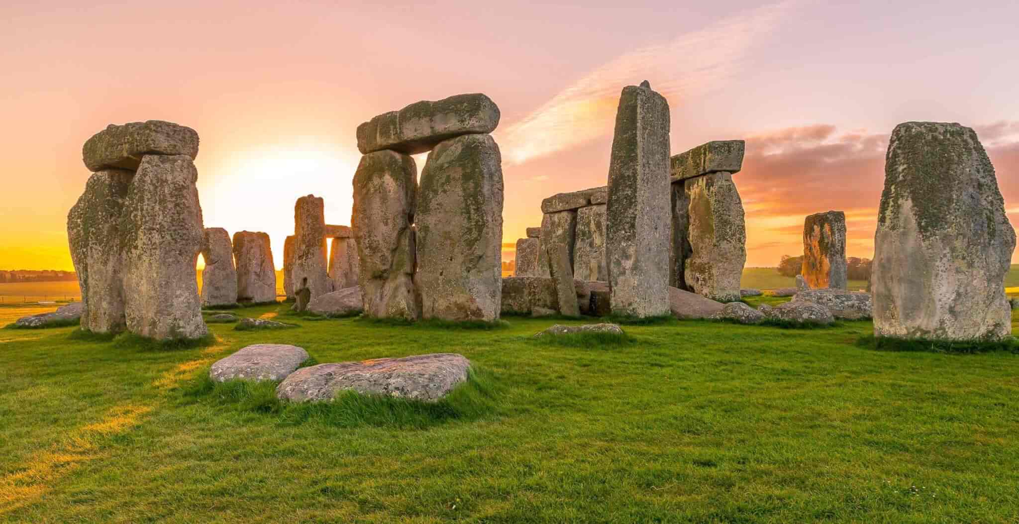


The far west of Cornwall is famed for its dramatic landscape and coastal beauty. Visitors flock here to enjoy the beaches of Mounts Bay and iconic landmarks such as Land’s End. Some, perhaps, will pay passing notice to the stone monuments which scatter the peninsula, standing starkly in fields or at roadsides. If these tourists find their interest piqued and stop for a closer look, they will discover a window into the vanished prehistory of three different ages…
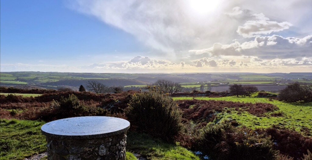
Penwith is where Britain ends. It is the final strip of land before the sea, stretching out a small finger into the ocean as though reaching forlornly for the sunset. Britain’s ancient inhabitants knew this just as we do, for Penwith is teeming with prehistoric sites that spark the imagination and add to the magical quality of the land.
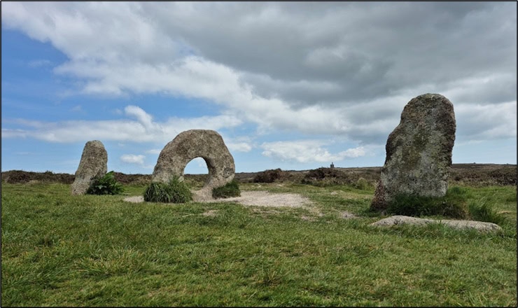
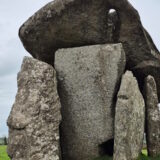
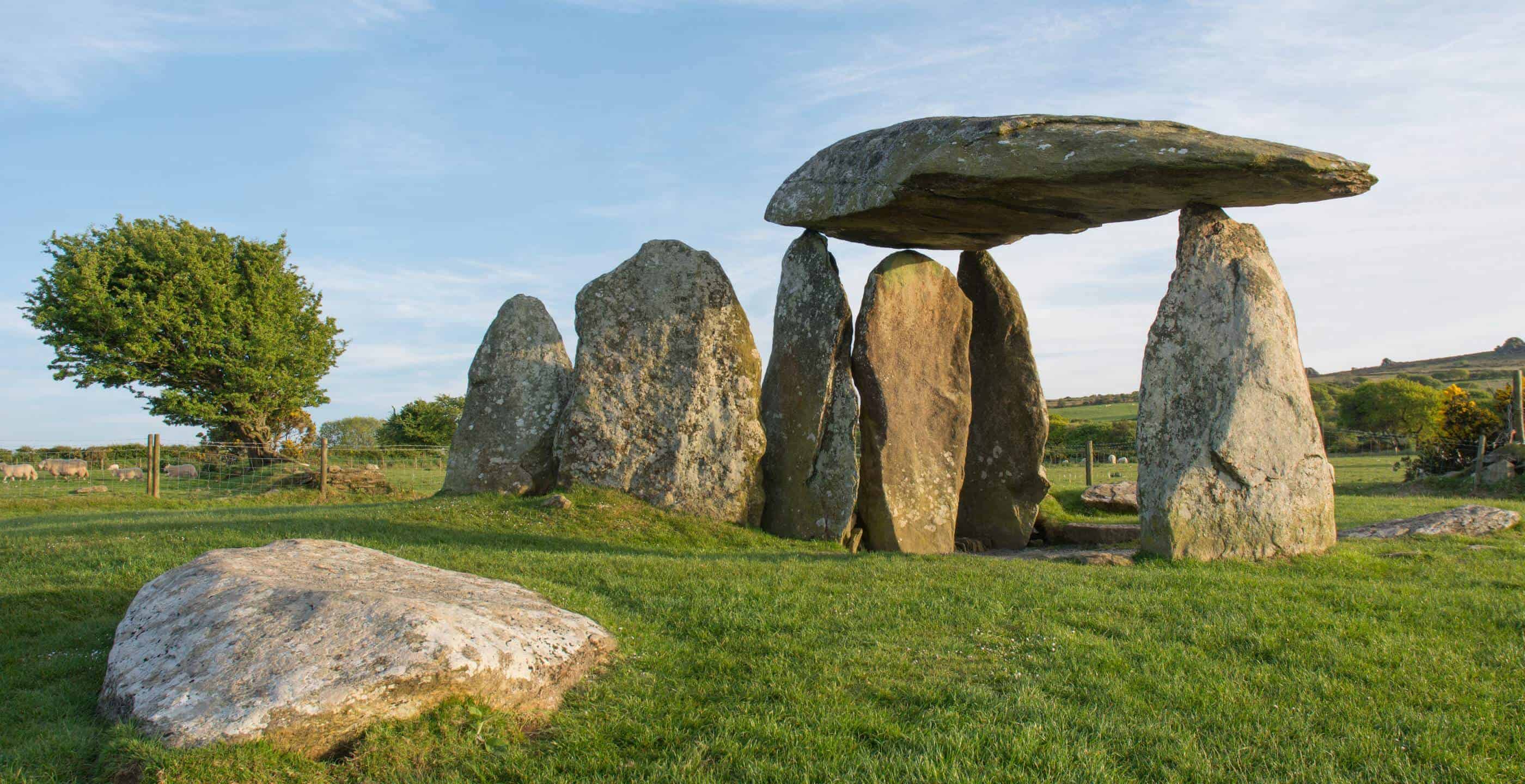
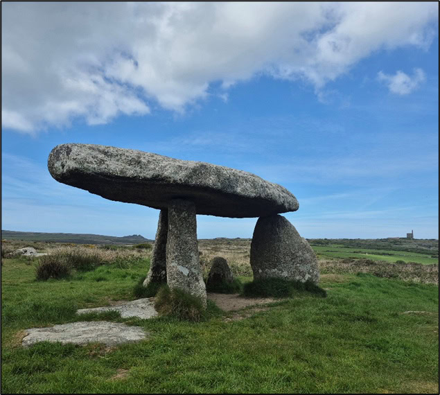
Take Men-an-Tol, a well-known site just north-west of Penzance. Here, a distinctive granite stone with a circular hole in its middle, the ‘Portal Stone’, is set between two standing stones, one in front and one behind it. The stones are small, no more than 1.2 metres high, and yet the arrangement holds an eerie aura of the uncanny. The hole could have been created by natural weathering of the granite, but it seems to have been enhanced by human hands. Likely dating to the late Stone Age, the stones have had their original arrangement altered over the millennia, probably more than once. It is possible that the standing stones once formed part of a stone circle with the Portal Stone at its centre; or that the Portal Stone formed part of a nearby tomb. For example, it could have been a piece of the entrance to the dolmen tomb Lanyon Quoit, which stands nearby. Once taller than a horse and rider, the tomb much altered in the 19th century.
Early archaeologist William Borlase was the first to record the folklore surrounding Men-an-Tol in the 1700s. It was said that a benign sprite (a ‘Piskie’) stood guardian to the stones and used them to grant miraculous cures. Children with rickets and injured locals were said to crawl through the ‘Portal’ in hopes of a cure, while mothers who suspected their babies to be ‘changelings’ switched out by evil spirits would pass their children through the hole to receive their real child back. Could these stories hint at the stones’ original purpose? Perhaps – some stone monuments have been hypothesised to play a part in healing rituals, and the hole could well have represented a gateway to an ‘otherworld’. But with almost nothing known about Men-an-Tol’s original form, we are left with only supposition.
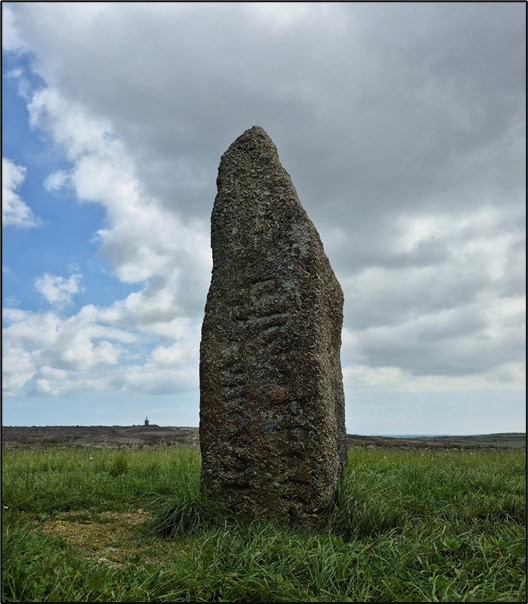
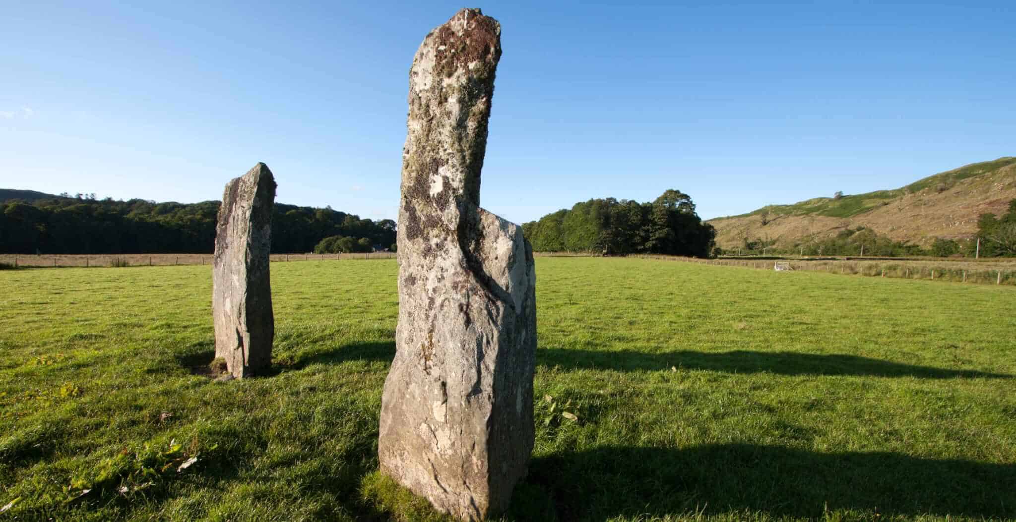
A short walk away, the stone of Men Scryfa stands tall and alone. This could originally have been one of Men-an-Tol’s circle stones. Unlike them, it bears a written inscription: ‘Rialobranus son of Cunovalus’. Barely visible today, these words seem to date from the Dark Ages (5th – 7th centuries). It is possible then that the stone was repurposed during this period – folklore is reported to say that Riolbran was a warrior killed in battle at the spot, with the stone set to mark his resting place. Somehow this seems a little too neat, not to mention that Riolbran was said to have been the exact height of the stone, nine feet. Nonetheless, the inscription does indicate that the local stone monuments were reused over time, perhaps by peoples who had lost the memory of their original importance but still revered their power.
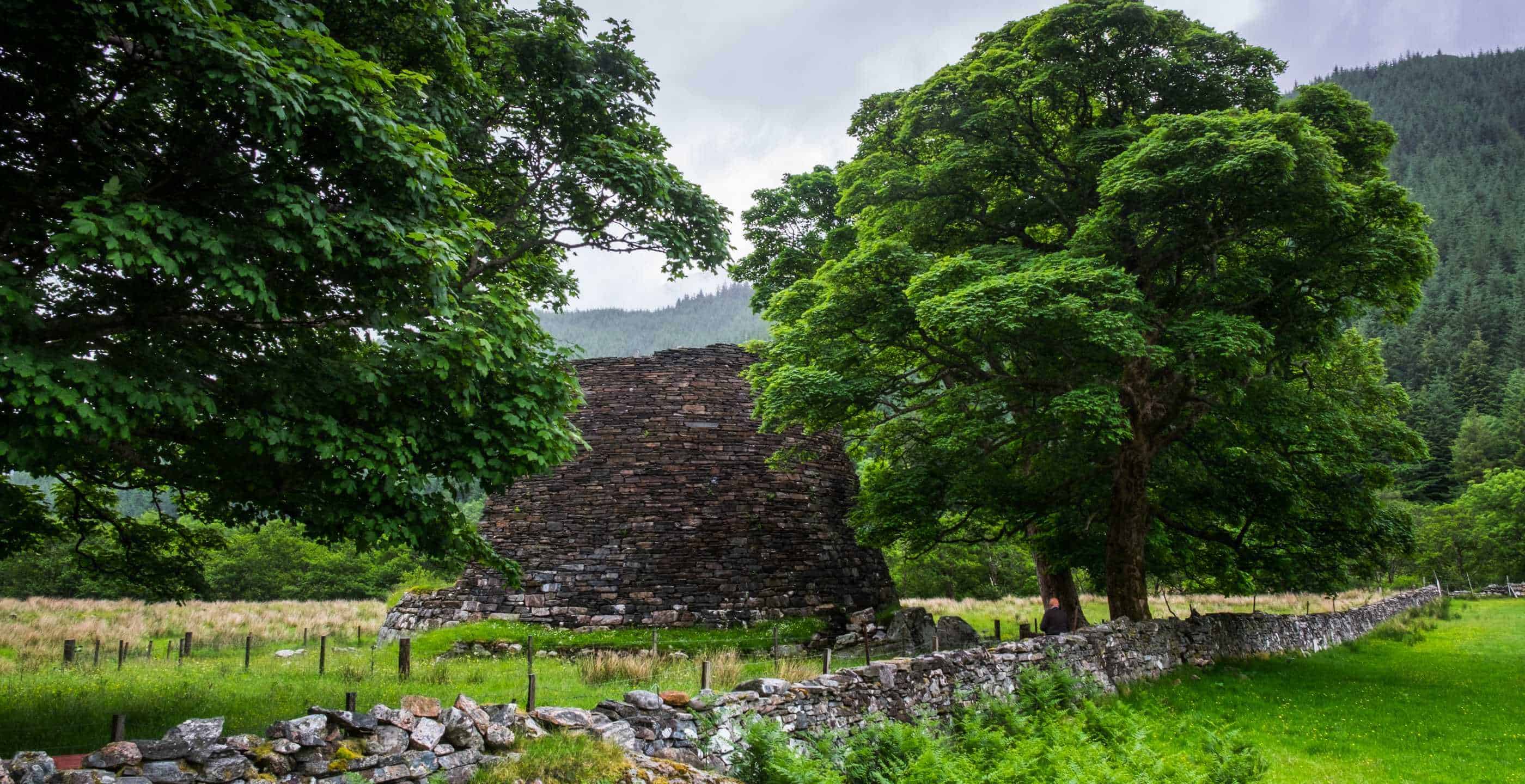
A few miles west, on the coast just north of Land’s End, sits the Bronze Age Ballowall Barrow. This tomb was built looking out to sea, perched atop the sheer cliffs, and is the most complex of the many funerary monuments that straddle the local seashore. A barrow tomb, it would originally have been an earthen mound covering a drystone structure. There were five chambers or ‘cists’ inside, housing pottery and cremated human remains. The barrow was concealed by debris from nearby tin mines until 1878, when it was excavated by William Copeland Borlase, Great-Grandson of the William Borlase who first studied Men-an-Tol. His excavation was professional by the standards of the time, but these were still the earlier days of archaeology – Borlase added a circular walk to the site to display his finds to the public, radically altering the Barrow’s appearance.
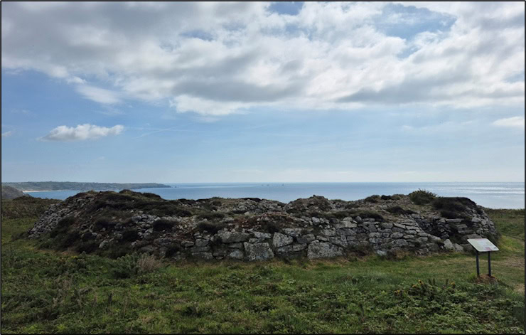
It is assumed that Ballowall’s original form would have been much more dramatic – perhaps a very large mound with a foreboding portal-entrance, similar to Bryn Celli Ddu on Anglesey. We can only surmise at the reasons for its coastal placement. It is possible that Ballowall’s original entrance pointed out to sea, towards sundown. This would connect it to the solar alignments of many other prehistoric sites, such as Trevethy Quoit. But whereas Stone Age Trevethy aligns to the sunrise, symbolising new life, Bronze Age Ballowall looks out towards the sunset, perhaps reflecting the different beliefs of the two periods. Maybe the tomb’s location was a way of sending the dead on their way to an ancestral land, thought to lie with the setting sun across the distant ocean waves?
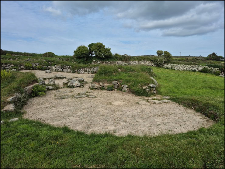
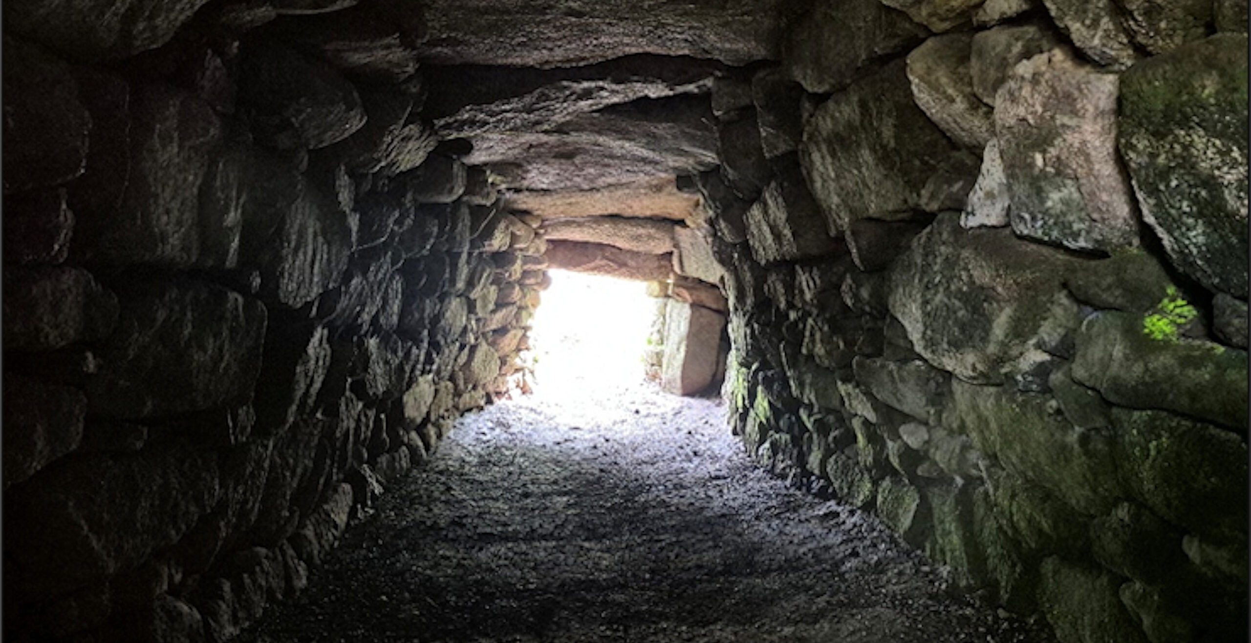
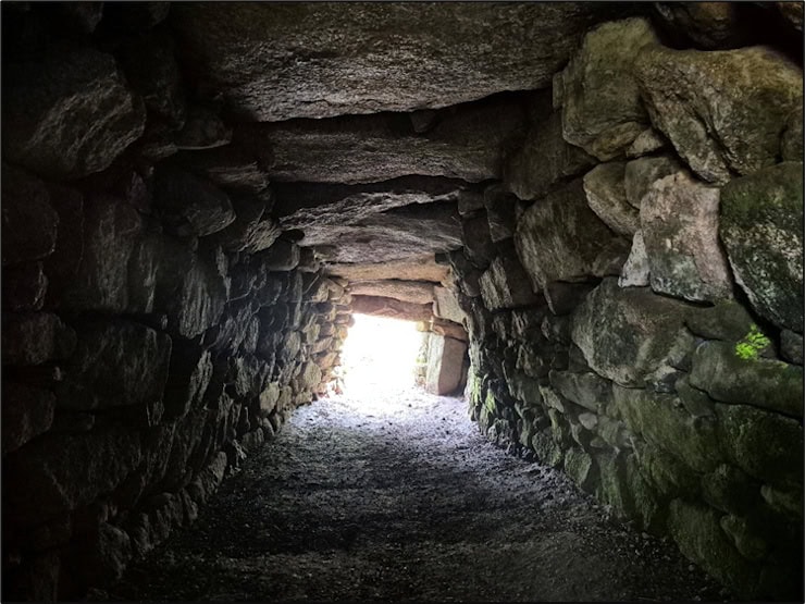
Finally we journey south and come to the Iron Age. Carn Euny lies on a hillside near prominent Sancreed Beacon, west of Newlyn. It is the remains of a village first built in timber around 500 BCE, then turned into stone and occupied until the end of the Roman period some 900 years later. The village is distinctive for two reasons: firstly, it was comprised of ‘courtyard houses’, a semi-communal design of interlocking house walls built around a central courtyard; secondly, it contains a Fogou, an underground chamber dug beneath the village whose purpose remains unknown. Both these qualities are unique to Cornwall in this period. Why build like this? One theory is that it provided for communal security, with interlocking defences and an underground refuge in times of threat. Equally, the Fogou may have provided an efficient storage area, a place for ceremony – or all of these at different times. The need to live in a tight-knit, defensible location may have been symptomatic of the Iron Age, in which a rising population and fierce competition for resources may have made for a more dangerous world.
These three sites are only a few miles apart and easily visited by car in a few hours, but span millennia in origin, their builders separated from each other by countless generations. The quality which they share is the mystery which hangs over them. We can never know their true purpose, what kind of rituals took place beside them, what they truly meant to the people who made them and lived alongside them for thousands of years. All we have to fill the gaps is folklore, patchy evidence, and our own imaginations. It is this atmosphere of ancient mystery hidden amongst a beautiful coastal landscape which makes the prehistoric sites of Penwith well worth a visit.
Mike Edwardson is a professional analyst and writer with an MA in History from The University of Sheffield. Passionate about uncovering the lesser-known stories of British history, Mike combines his analytical skills with a love for storytelling to bring the past to life.
Published: 16th June 2025.