Thames Trail App Review
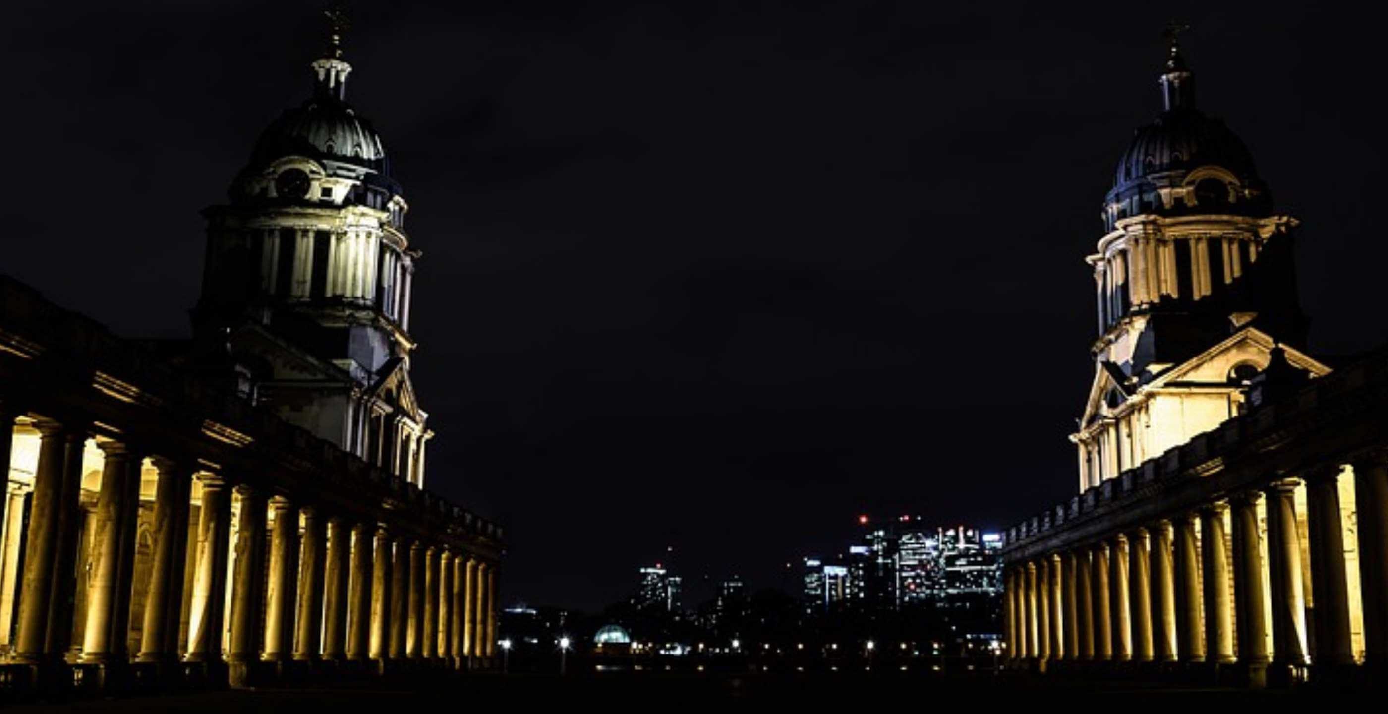
The Thames riverside in Greenwich is undoubtedly one of the hidden treasures of London. From the Old Naval College through the quirky sidestreets of East Greenwich and through to the O2 Arena, this stretch of river has seen almost constant change over the past 500 years.
Fast forward to 2013 and Viewfinder Photography Gallery have just released a brand new app offering an interactive photowalk of the Thames Trail in Greenwich, guiding visitors through the rich riverside history and heritage from the Cutty Sark to the brand new cable car on the Greenwich Peninsula.
Earlier this month we were given a pre-release version of the app to take for a test drive. Although we were trying out the app on a Galaxy Note 2 (Android), it is also being released for the Apple iPhone through the App Store.
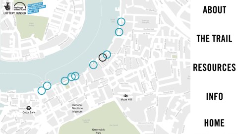
Above: The app follows the Greenwich riverside from the Cutty Sark to the O2 Arena
We started our test drive at the Cutty Sark where the app immediately picked up our location and – being partially voiced – began by giving us an overview of the areas that we would be walking through.
As we headed east past the Old Naval College the app was springing into action every few minutes or so, both with voiceovers and accompanying photographs showing how the area had changed from its industrial past.
Walking past the Trafalgar Tavern with its hordes of tourists and sightseers, it was absolutely fascinating to see how the area has changed from its origins as a working class dockland to the gentrified suburb that it is today.
For us however, the best part of the route was towards the end at Greenwich Peninsula. This rather isolated patch of land is one of the few remaining stretches of industrial riverside in London, with many of the old jettys, warehouses and even a tied up barge or two still surviving to this day. This rather dystopian urban environment continues up to the O2 Arena where the app’s journey unfortunately comes to an end.
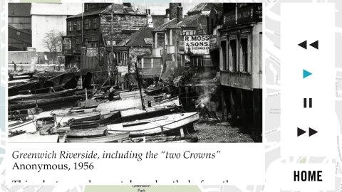
Above: The app makes use of high resolution archive photography to show how the riverside has changed over the years.
The developers of the Thames Trail app have obviously searched high and low for local residents, historians and artists who can bring their first hand experiences of the area to life. At times it feels as though you have your very own local tour guide and for us, this is what makes the app stand out from some of the other ‘guided’ experiences on the App Store.
We were also impressed with the quality of the high resolution images and the voiceovers, and the app even allows you to publish your own photographs of the route and have them published on the Viewfinder Photography Gallery’s website via Flickr.
It would be nice to see the app scaled up in future releases, perhaps expanding towards the Charlton riverfront and on to Woolwich, but even so, this is one of the best history apps we’ve seen on the market to date. The Thames Trail App is released on the 5th June 2013, free of charge, and is available for both Android and iOS. You can download the app at the links below: